
MAPS
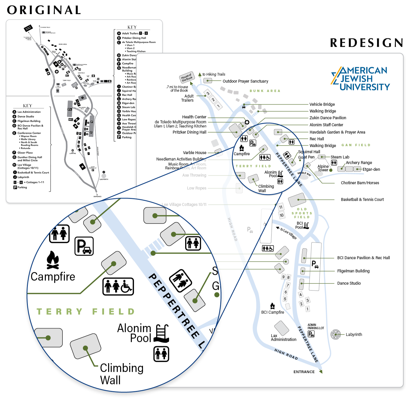
I frequently redesign maps to improve clarity and focus on essential information, rather than displaying extraneous detail and competitors as consumer mapping tools often do. For American Jewish University’s Brandeis-Bardin campus map, I removed the keys entirely, making directions faster to understand and easier to act on while reducing confusion and unnecessary walking.
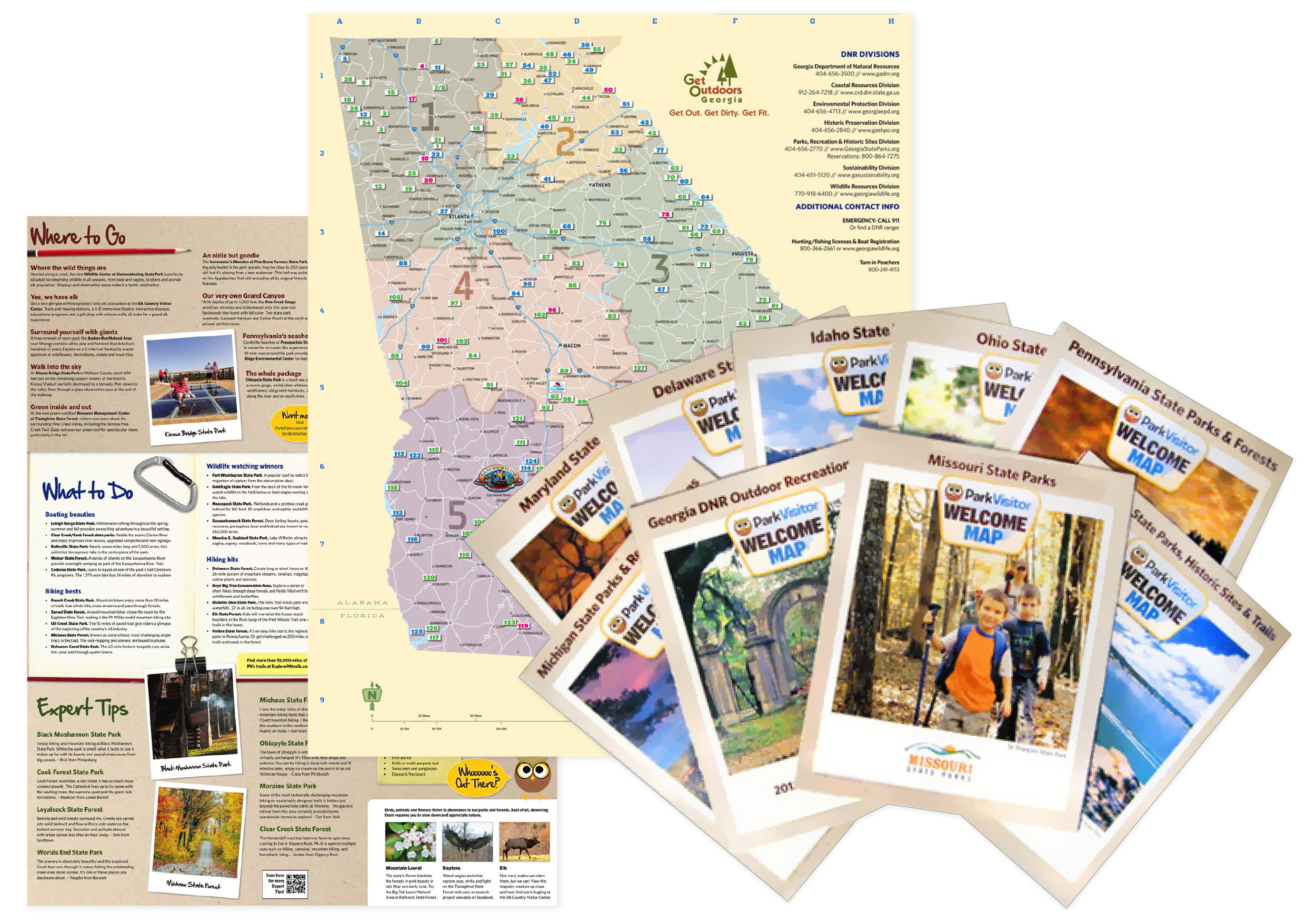
I created official state park maps for multiple states, featuring extensive park-specific highlights, sustainability goals, partner messaging, safety tips, and wildlife facts. I was directly involved throughout the process, from map and layout design through content integration and the large-scale printing of millions of maps.
