Map of the American Jewish University campus showing various buildings, fields, pathways, parking areas, and landmarks like campfires, sports fields, and activity centers.

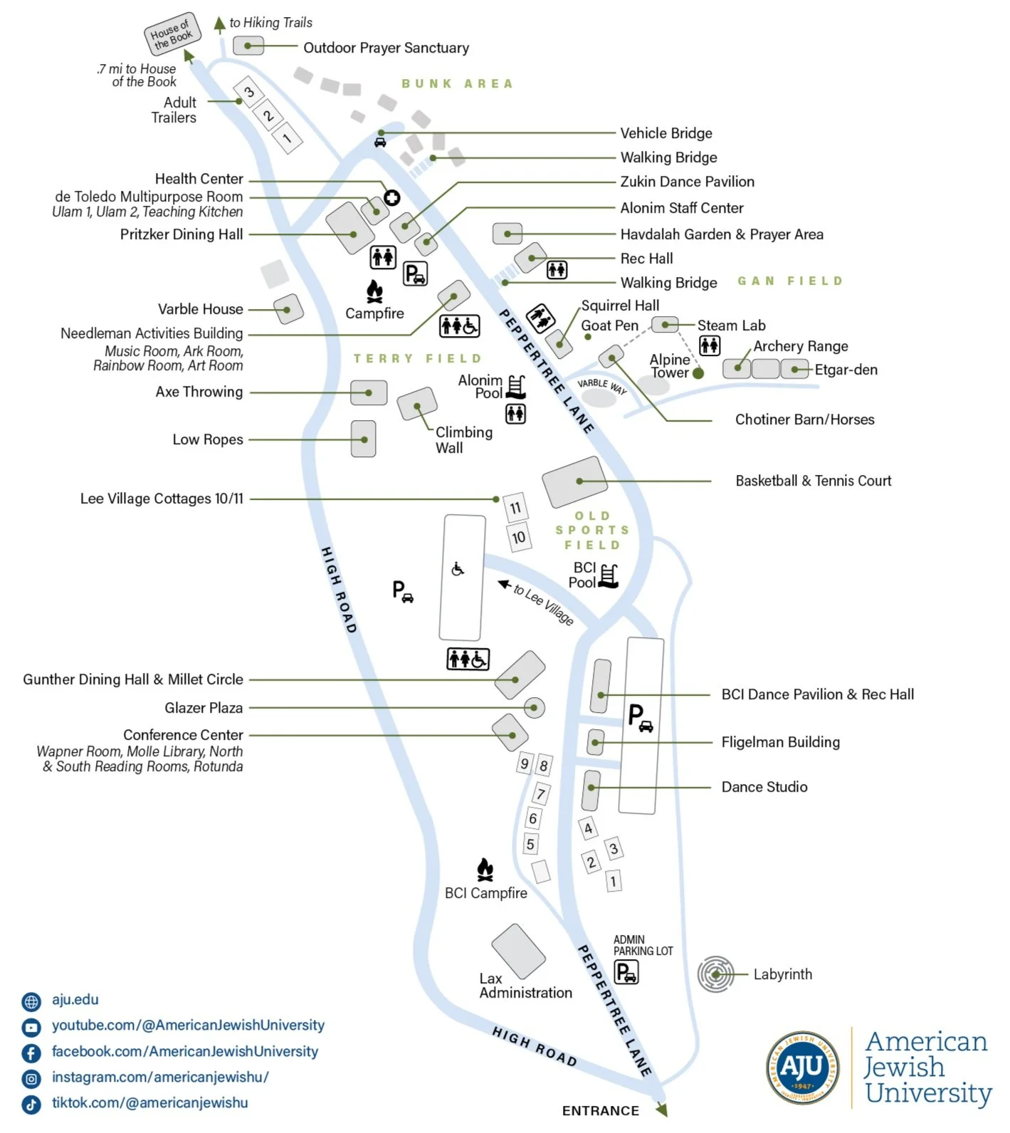
Map, Siteplan and Floorplan Design

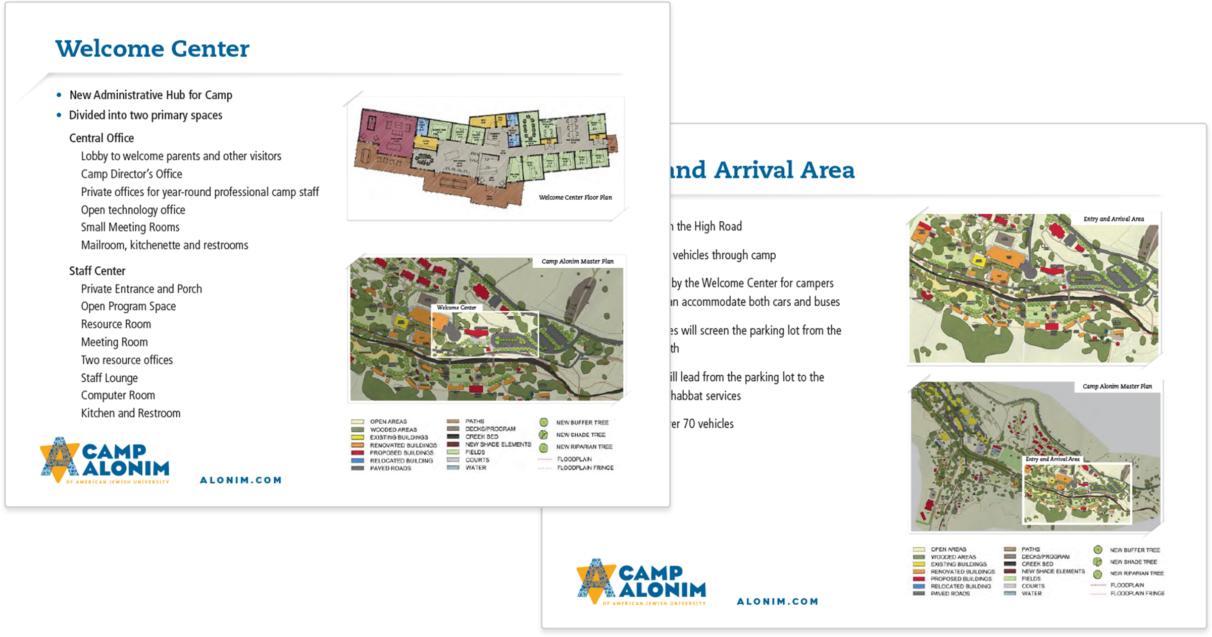
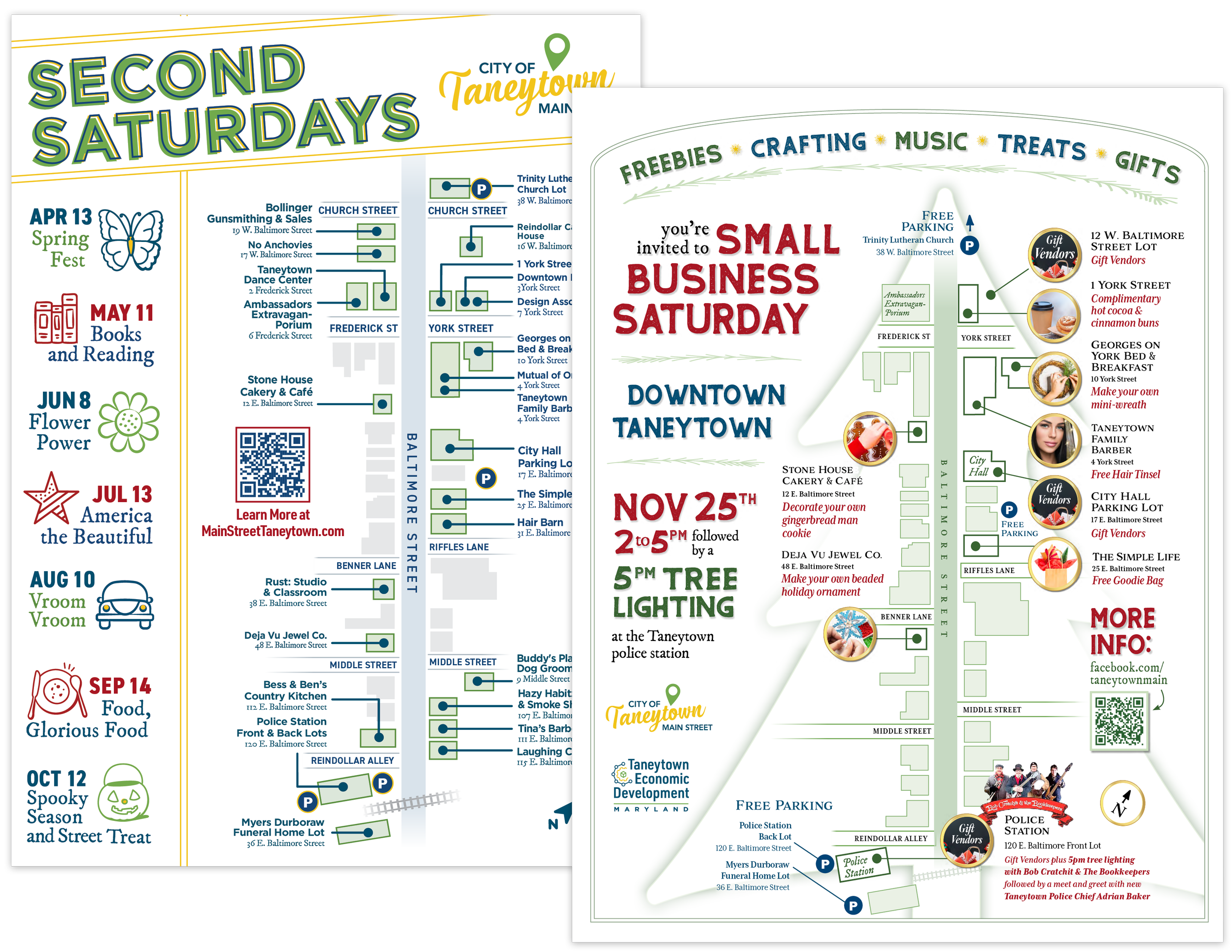
Optimized for better legibility, versatility, and ADA compliance

Two informational maps of Camp Alonim, showing the Welcome Center and Grand Arrival Area with location labels and directional pathways, accompanied by descriptive text and legend.
Map showing directions to various locations in Tucson, including major roads and landmarks.
Map of UCLA campus showing lower and upper campus areas, buildings like the auditorium, administration, academic wing, colonnade conference center, residential complex, basketball court, parking area, and nearby landmarks including Santa Monica Mountains, San Diego Freeway (405), Ventura Freeway (101), LAX airport, Getty Museum, and downtown Los Angeles.
Event map for Taneytown, Maryland, including participation dates, locations, and activities such as Second Saturdays on April 13 with crafts and treats, Books and Reading on May 11, Flower Power on June 8, America the Beautiful on July 13, Vroom Vroom on August 10, Food, Glorious Food on September 14, and Spooky Season and Street Treat on October 12. It features a layout of downtown Taneytown with marked parking lots, streets, and vendor locations, and includes details for a Small Business Saturday event on November 25 with tree lighting and holiday activities.
Comparison of architectural plans showing a building layout before and after renovation, with the "Before" plan on the left and the "After" plan on the right, highlighting modifications in the structure and room arrangements.
Set of five welcome maps for various U.S. states and national parks. The maps feature colorful images of landscapes and outdoor scenes, along with detailed lists of parks and attractions.
Map of Custer State Park with various trails and points of interest, a sign indicating modern restrooms at Peter Norbeck Visitor Center 3 miles ahead, and two people looking at a map near the sign.
A multi-page guide titled 'Arizona Watchable Wildlife Guide' with information and images of various wildlife species, camping tips, and a map of Arizona State Parks, published by the Arizona Watchable Wildlife Tourism Association.